Xangsane
squishy squishy!
- Joined
- Jun 11, 2021
- Posts
- 160,607
- Reputation
- 140,208
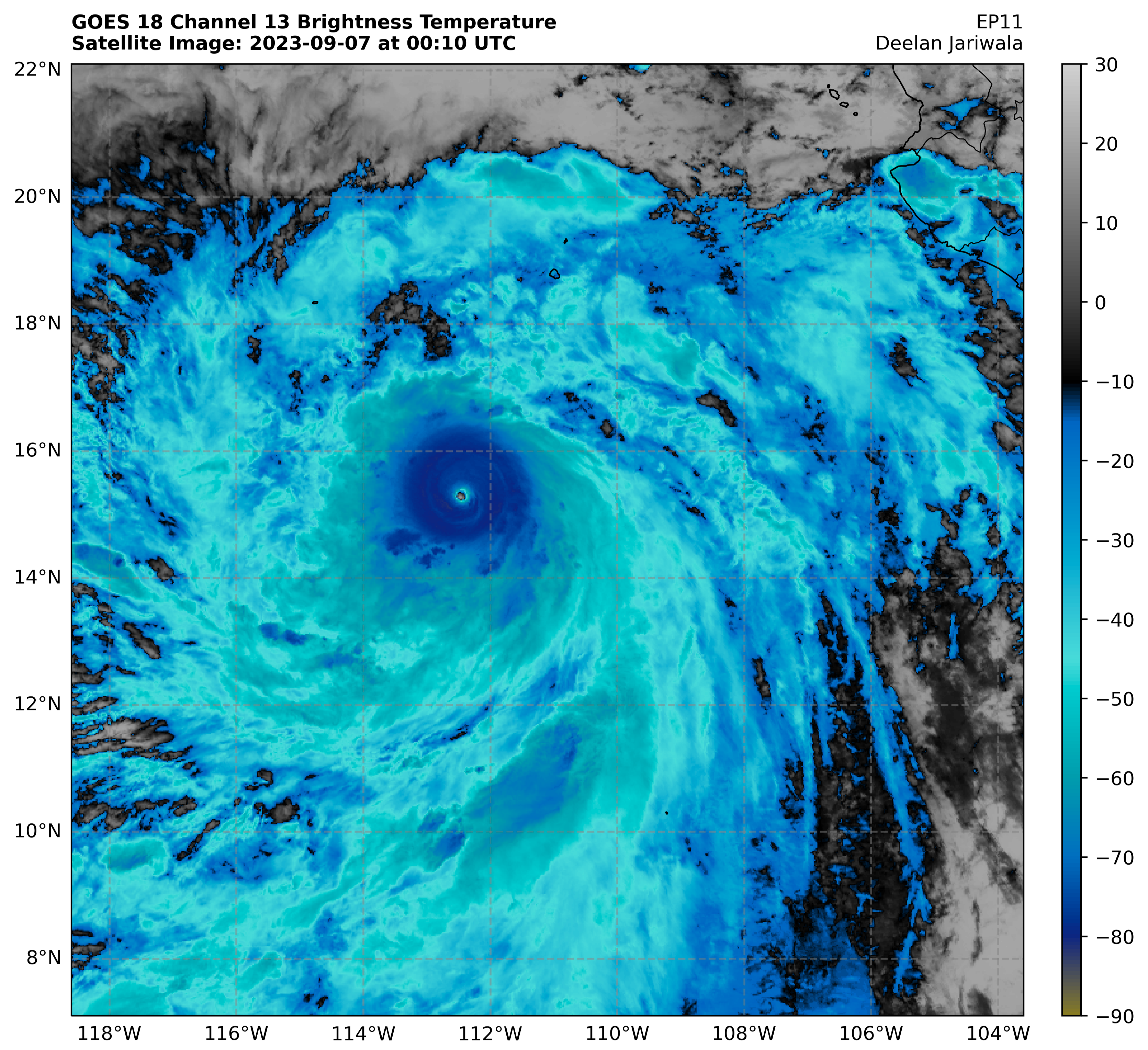
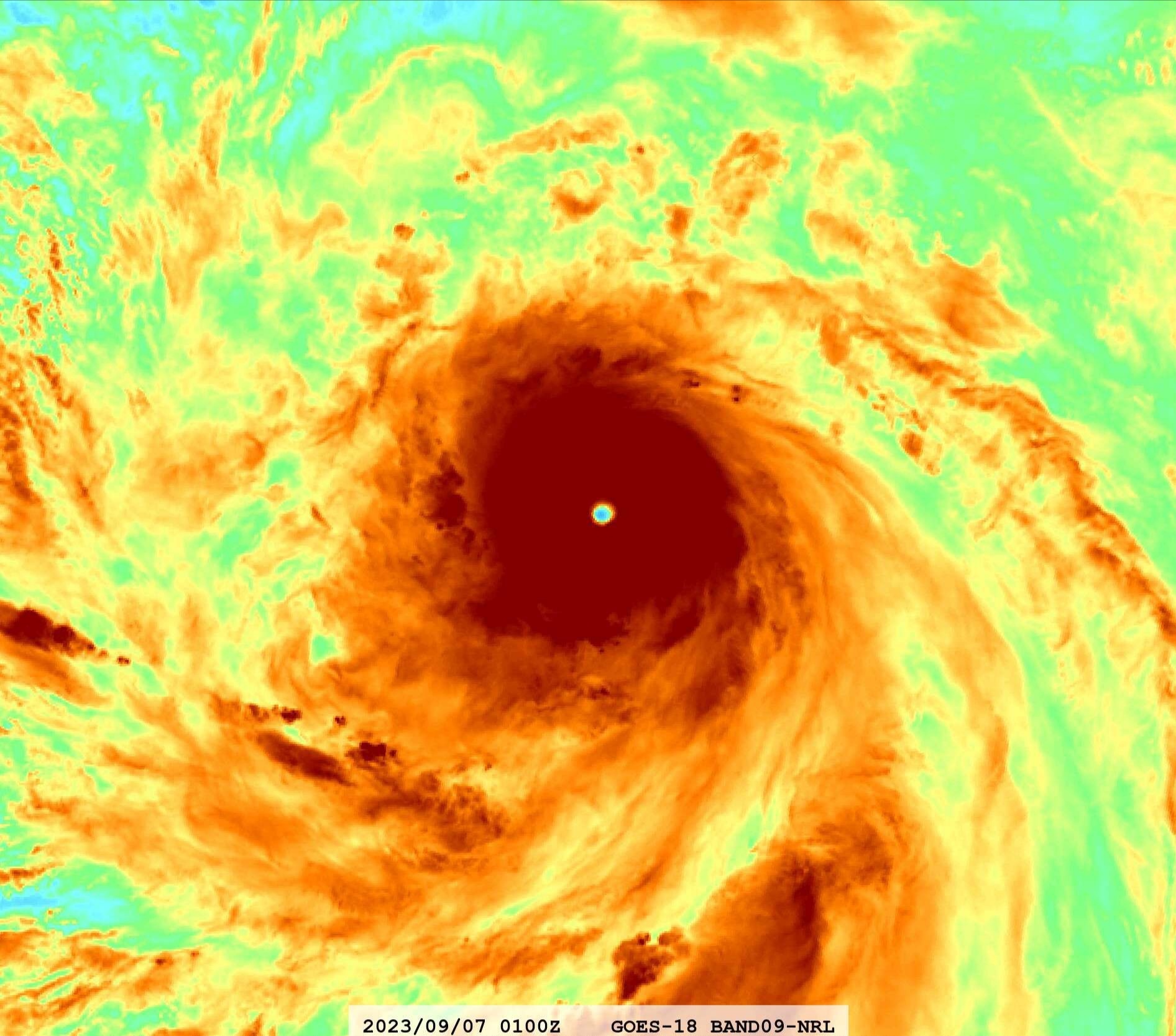
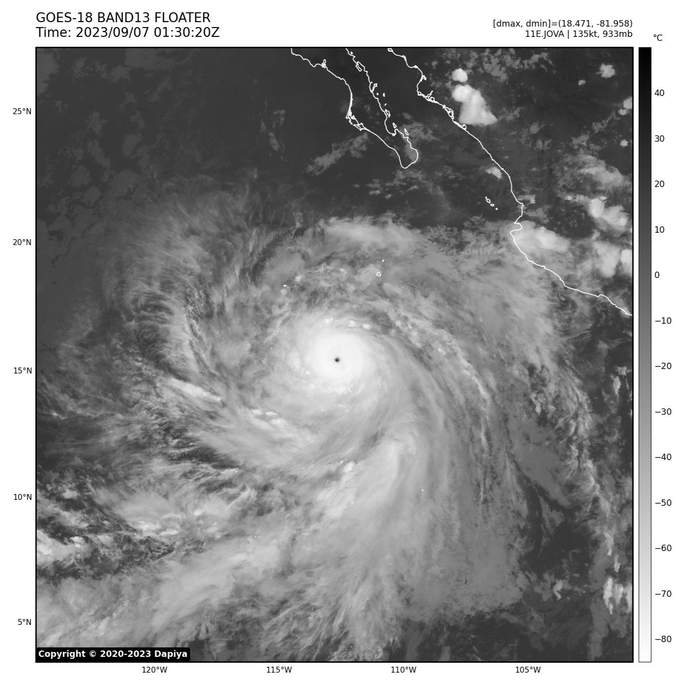
Probably a Category 5 right now, but yet to be confirmed. Mogs Lee hard.





Follow along with the video below to see how to install our site as a web app on your home screen.

Note: this_feature_currently_requires_accessing_site_using_safari


JFLBig hole


Why?Htb purely because of the name
Would've been Stacy with a better name


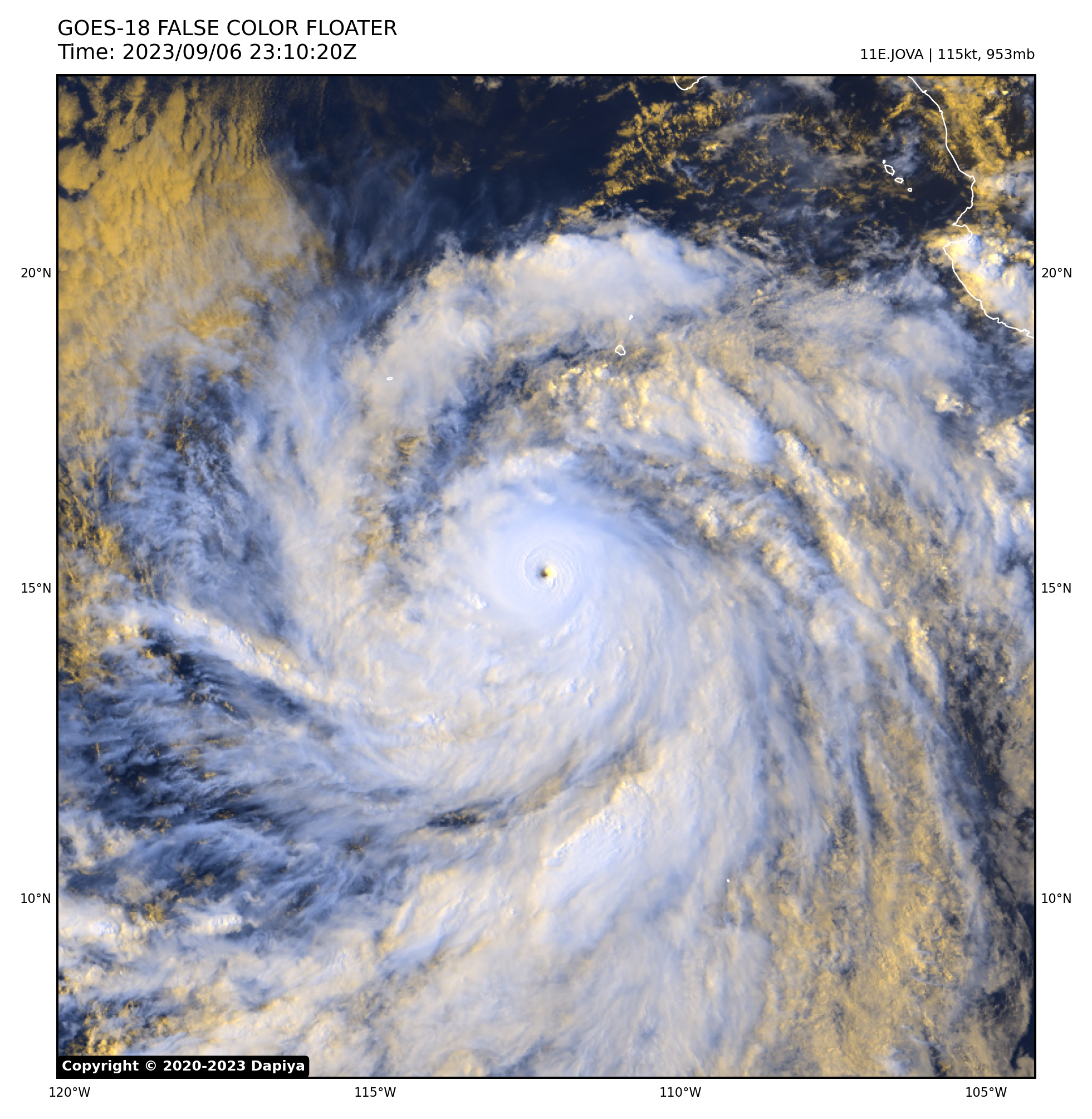
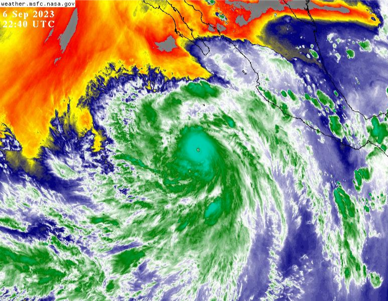
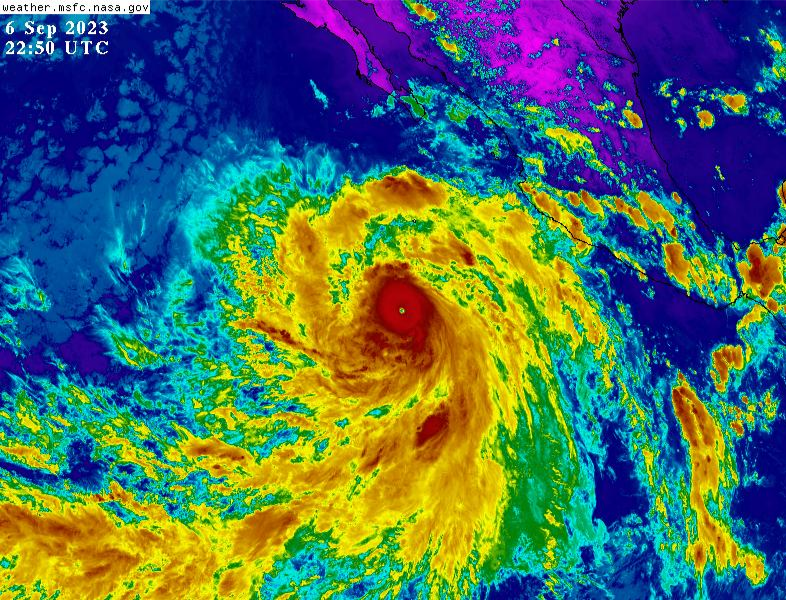
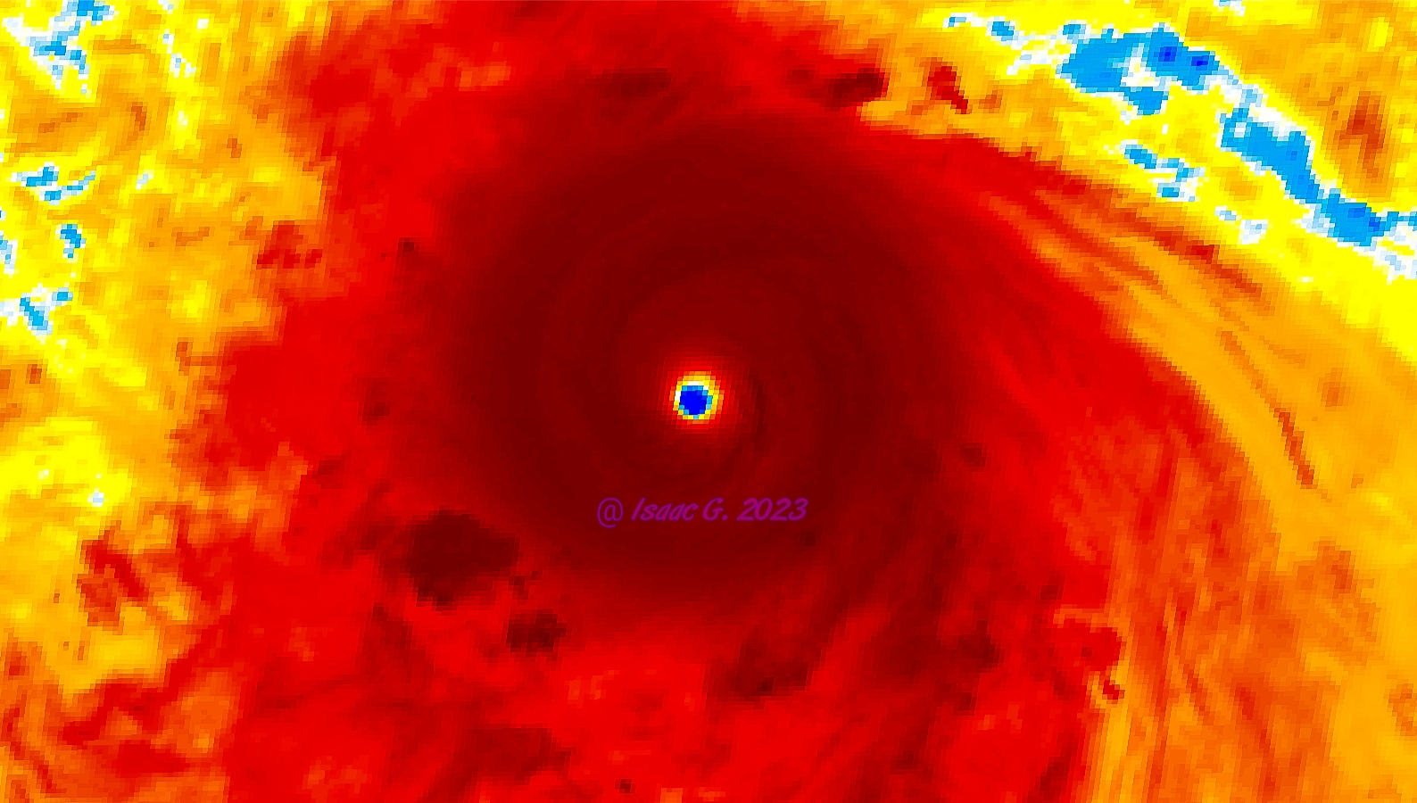
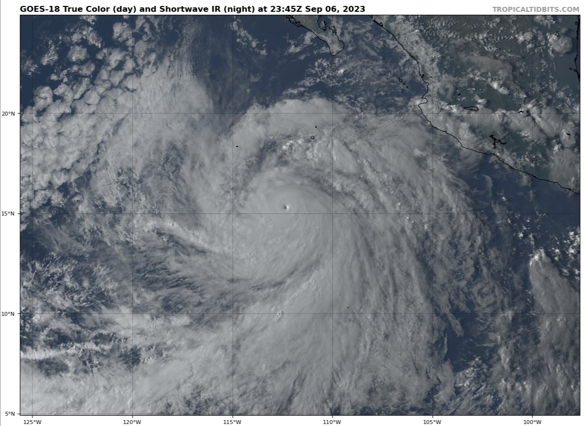
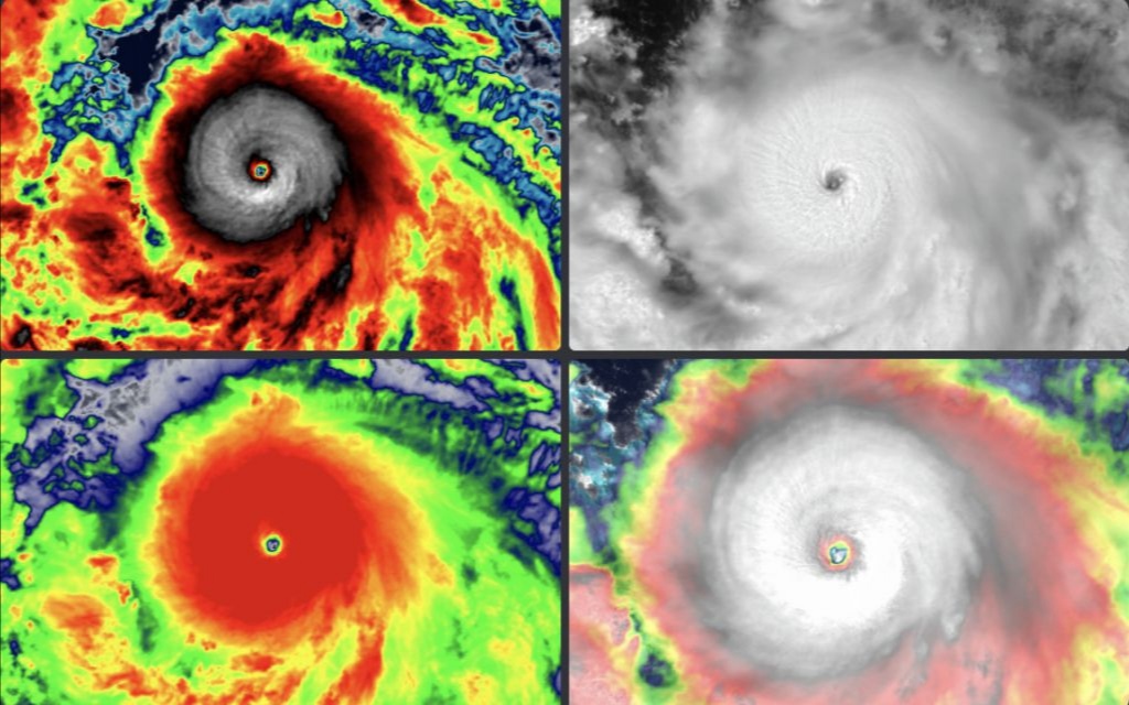
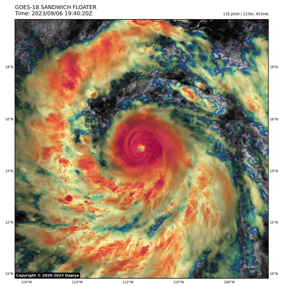
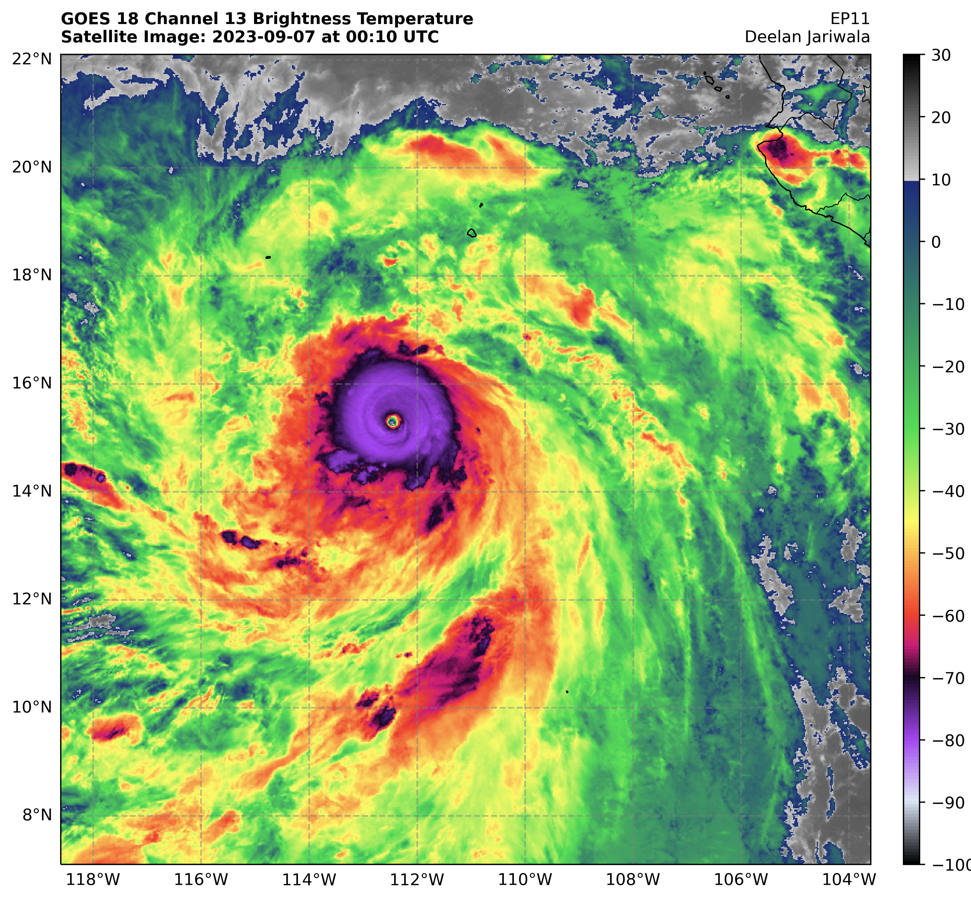
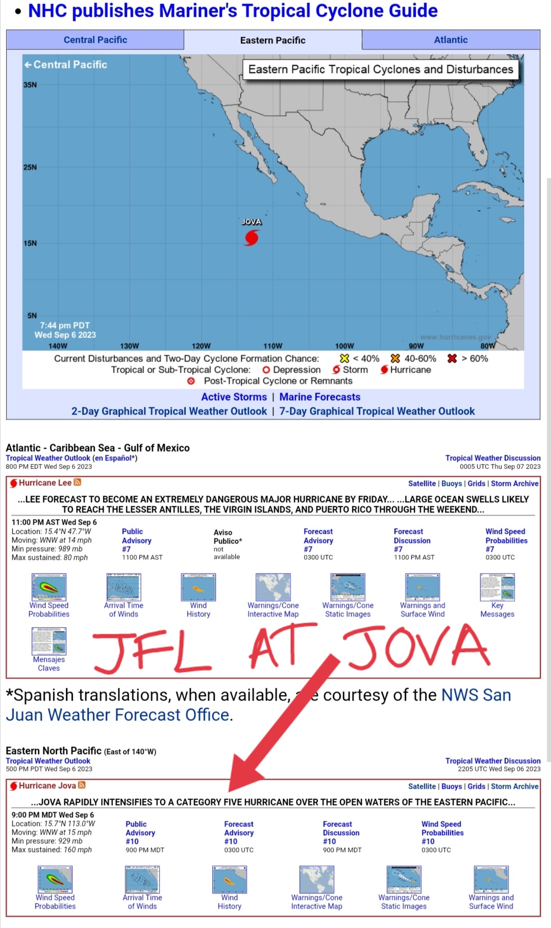
...JOVA RAPIDLY INTENSIFIES TO A CATEGORY FIVE HURRICANE OVER THE
OPEN WATERS OF THE EASTERN PACIFIC...
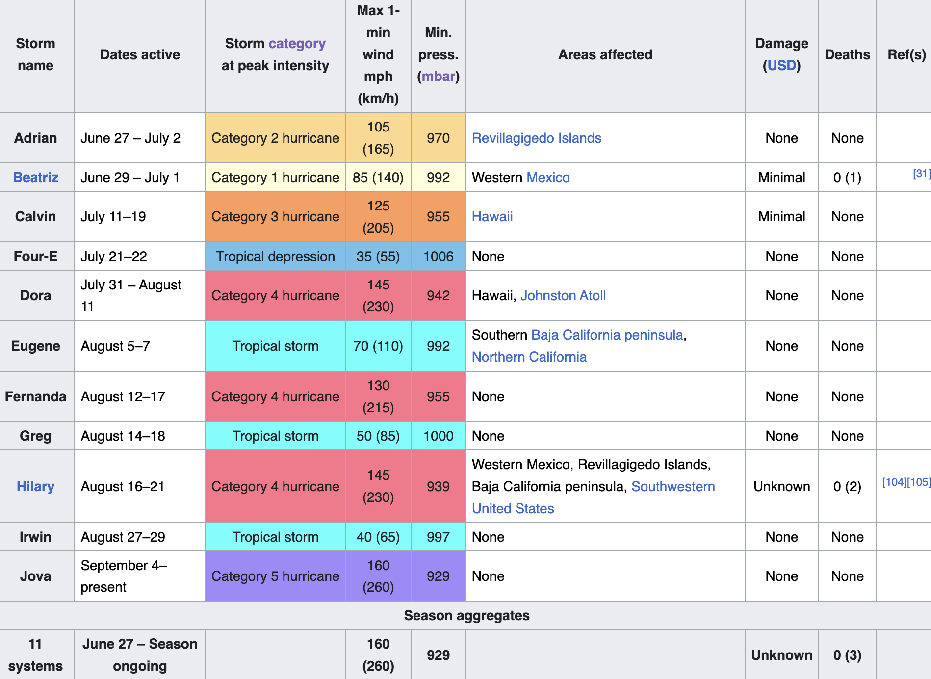
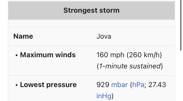
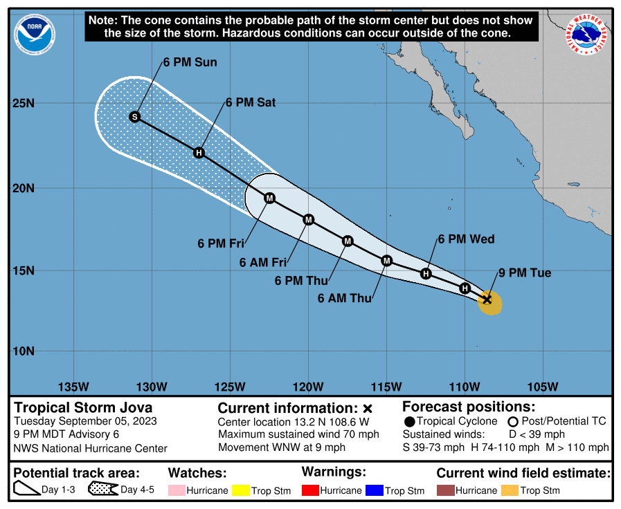
View attachment 2419805View attachment 2419806View attachment 2419807
SUMMARY OF 900 PM MDT...0300 UTC...INFORMATION
----------------------------------------------
LOCATION...15.7N 113.0W
ABOUT 535 MI...865 KM SSW OF THE SOUTHERN TIP OF BAJA CALIFORNIA
MAXIMUM SUSTAINED WINDS...160 MPH...260 KM/H
PRESENT MOVEMENT...WNW OR 300 DEGREES AT 15 MPH...24 KM/H
MINIMUM CENTRAL PRESSURE...929 MB...27.44 INCHES
Jova is weird name for a womanWhy?
I've never seen or heard of a woman named jovaWhy?
@Graham @HeightPilledum
BBC only
@RetardSubhuman thoughts?BBC only
BBC only
I've never seen or heard of a woman named jova
Wtf is up with your obsession with a hurricane nigga

Likely made upI've never seen or heard of a woman named jova
It does mog
Because it's maximum winds are 260kmhY
@Debetro
I fucking caged when they made her a Category 5Because it's maximum winds are 260kmh
It's insane how jova is destroying lee right nowI fucking caged when they made her a Category 5
Everyone thought so tooIt's insane how jova is destroying lee right now
I thought Lee was gonna mog

Lets keep track of that flightEveryone thought so too
https://looksmax.org/threads/mog-battle-who-will-mog-harder-jova-or-lee.812926/

[MOG BATTLE] WHOSE PATH MOGS? LEE OR JOVA?
WHOSE PATH MOGS? LEE JOVA https://looksmax.org/threads/mog-battle-who-will-mog-harder-jova-or-lee.812926/ @slop slinger @howtallareyoulooksmax.org
@slop slinger was right
Thoughts and prayers for these kiwicels
View attachment 2419839
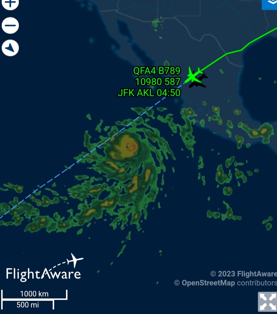
Lets keep track of that flight

I do believe yes
What do you rate Jova?Lets keep track of that flight
Why?I do believe yes
Are they rerouting?
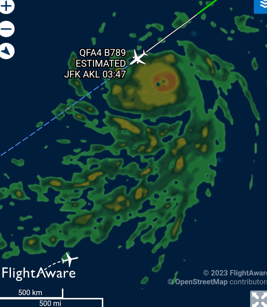
Looks like they're flying into Jova (which is a Category 5)Are they rerouting?
Surely change course they will!Looks like they're flying into Jova (which is a Category 5)

QF4 (QFA4) Qantas Flight Tracking and History - FlightAware
Track Qantas (QF) #4 flight from John F Kennedy Intl to Aucklanduk.flightaware.com
JFL
JOVA FUCKING DID IT
CATEGORY 5 CONFIRMED
View attachment 2419803View attachment 2419804
@slop slinger @howtallareyou
Hurricane Jova Discussion Number 10
NWS National Hurricane Center Miami FL EP112023
900 PM MDT Wed Sep 06 2023
The remarkable rapid intensification (RI) of Jova has continued this
evening. The hurricane's very warm, 10 n-mi-wide eye is surrounded
by a symmetric central dense overcast of convective cloud tops
colder than -75 deg C. Recent SSMIS microwave images suggest an
eyewall replacement cycle (ERC) is underway, with signs of a
formative secondary eyewall noted in 89-GHz imagery. The GOES
Geostationary Lightning Mapper has also shown an increase in inner
core lightning activity during the past several hours. Based on
Dvorak data-T numbers of 7.0 from SAB and TAFB at 00 UTC and rapidly
climbing objective intensity estimates, the initial intensity of
Jova is raised to 140 kt. This makes Jova a category 5 hurricane on
the Saffir-Simpson Hurricane Wind Scale and signifies an 80-kt
intensity increase over the past 24 h.
The onset of an ERC and the recent lightning activity suggest that
the hurricane could be nearing its peak intensity. Structural
changes related to the ERC could cause some near-term intensity
fluctuations, but the NHC forecast still allows for a bit more
strengthening overnight given Jova's striking satellite presentation
and the conducive oceanic and atmospheric conditions along its path.
The hurricane is forecast to reach the 26C isotherm in 36-48 h,
after which time a faster rate of weakening is forecast while Jova
moves over cooler waters and into a drier mid-level environment.
Regardless, Jova is likely to remain a powerful hurricane for the
next few days. This forecast shows Jova keeping its tropical cyclone
status through day 5, although the global models suggest it could be
mostly devoid of convection and nearly post-tropical by the end of
the forecast period.
A mid-level ridge centered over northern Mexico is steering Jova to
the west-northwest (300/13 kt). With the ridge entrenched to its
north, the hurricane is expected to continue on a west-northwestward
heading for the next several days, as depicted by the well-clustered
track guidance. The updated NHC forecast lies very close to the
previous prediction, but once again has been adjusted slightly
faster based on the latest TVCN and HCCA consensus aids. As the
cyclone gradually spins down and weakens over cooler waters, the
shallow vortex is forecast to turn more westward at days 4 and 5.
FORECAST POSITIONS AND MAX WINDS
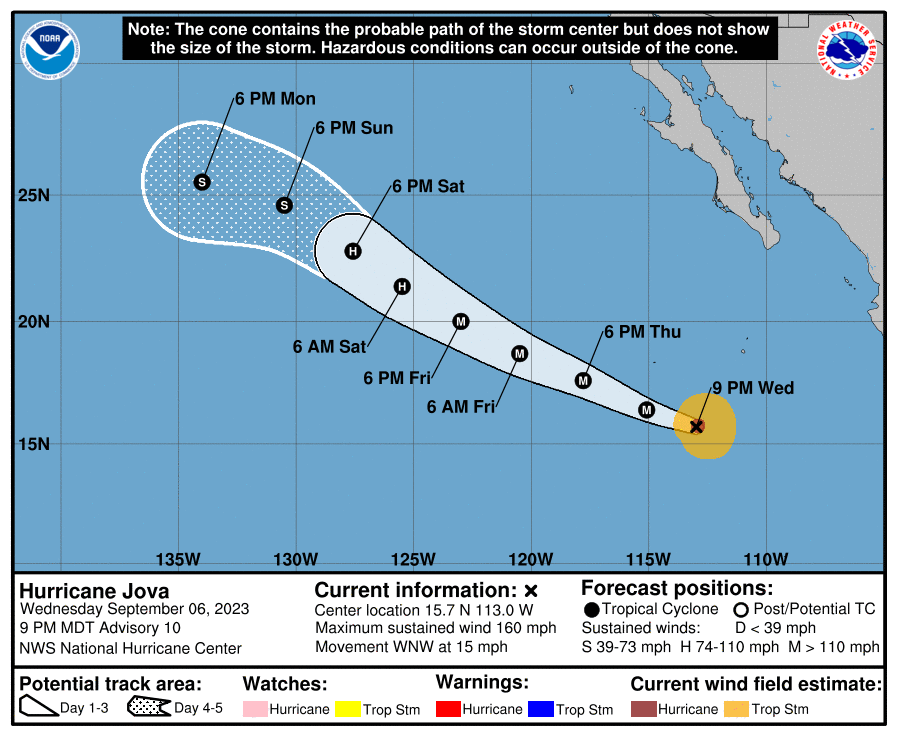
INIT 07/0300Z 15.7N 113.0W 140 KT 160 MPH12H 07/1200Z 16.4N 115.1W 150 KT 175 MPH
24H 08/0000Z 17.6N 117.8W 135 KT 155 MPH
36H 08/1200Z 18.7N 120.5W 120 KT 140 MPH
48H 09/0000Z 20.0N 123.0W 100 KT 115 MPH
60H 09/1200Z 21.4N 125.5W 85 KT 100 MPH
72H 10/0000Z 22.8N 127.6W 65 KT 75 MPH
96H 11/0000Z 24.6N 130.5W 45 KT 50 MPH
120H 12/0000Z 25.5N 134.0W 35 KT 40 MPH
$$
Forecaster Barrett
@tooLOW
They should. Let's see if they penetrate Jova or avoid herSurely change course they will!
BRUTALLY.It's insane how jova is destroying lee right now

Why?I thought Lee was gonna mog
It's insane how jova is destroying lee right now
I thought Lee was gonna mog

Will Jova hit land
That's brutalEveryone thought so too
https://looksmax.org/threads/mog-battle-who-will-mog-harder-jova-or-lee.812926/

[MOG BATTLE] WHOSE PATH MOGS? LEE OR JOVA?
WHOSE PATH MOGS? LEE JOVA https://looksmax.org/threads/mog-battle-who-will-mog-harder-jova-or-lee.812926/ @slop slinger @howtallareyoulooksmax.org
@slop slinger was right
Thoughts and prayers for these kiwicels
View attachment 2419839
No.Will Jova hit land
Thanks! Thoughts? It's a chad traitmirin the autistic niche hobby. i have no special hobby i feel like i have no personality
Yes.That's brutal
@StrangerDangerJFL
JOVA FUCKING DID IT
CATEGORY 5 CONFIRMED
View attachment 2419803View attachment 2419804
@slop slinger @howtallareyou
Hurricane Jova Discussion Number 10
NWS National Hurricane Center Miami FL EP112023
900 PM MDT Wed Sep 06 2023
The remarkable rapid intensification (RI) of Jova has continued this
evening. The hurricane's very warm, 10 n-mi-wide eye is surrounded
by a symmetric central dense overcast of convective cloud tops
colder than -75 deg C. Recent SSMIS microwave images suggest an
eyewall replacement cycle (ERC) is underway, with signs of a
formative secondary eyewall noted in 89-GHz imagery. The GOES
Geostationary Lightning Mapper has also shown an increase in inner
core lightning activity during the past several hours. Based on
Dvorak data-T numbers of 7.0 from SAB and TAFB at 00 UTC and rapidly
climbing objective intensity estimates, the initial intensity of
Jova is raised to 140 kt. This makes Jova a category 5 hurricane on
the Saffir-Simpson Hurricane Wind Scale and signifies an 80-kt
intensity increase over the past 24 h.
The onset of an ERC and the recent lightning activity suggest that
the hurricane could be nearing its peak intensity. Structural
changes related to the ERC could cause some near-term intensity
fluctuations, but the NHC forecast still allows for a bit more
strengthening overnight given Jova's striking satellite presentation
and the conducive oceanic and atmospheric conditions along its path.
The hurricane is forecast to reach the 26C isotherm in 36-48 h,
after which time a faster rate of weakening is forecast while Jova
moves over cooler waters and into a drier mid-level environment.
Regardless, Jova is likely to remain a powerful hurricane for the
next few days. This forecast shows Jova keeping its tropical cyclone
status through day 5, although the global models suggest it could be
mostly devoid of convection and nearly post-tropical by the end of
the forecast period.
A mid-level ridge centered over northern Mexico is steering Jova to
the west-northwest (300/13 kt). With the ridge entrenched to its
north, the hurricane is expected to continue on a west-northwestward
heading for the next several days, as depicted by the well-clustered
track guidance. The updated NHC forecast lies very close to the
previous prediction, but once again has been adjusted slightly
faster based on the latest TVCN and HCCA consensus aids. As the
cyclone gradually spins down and weakens over cooler waters, the
shallow vortex is forecast to turn more westward at days 4 and 5.
FORECAST POSITIONS AND MAX WINDS
INIT 07/0300Z 15.7N 113.0W 140 KT 160 MPH12H 07/1200Z 16.4N 115.1W 150 KT 175 MPH
24H 08/0000Z 17.6N 117.8W 135 KT 155 MPH
36H 08/1200Z 18.7N 120.5W 120 KT 140 MPH
48H 09/0000Z 20.0N 123.0W 100 KT 115 MPH
60H 09/1200Z 21.4N 125.5W 85 KT 100 MPH
72H 10/0000Z 22.8N 127.6W 65 KT 75 MPH
96H 11/0000Z 24.6N 130.5W 45 KT 50 MPH
120H 12/0000Z 25.5N 134.0W 35 KT 40 MPH
$$
Forecaster Barrett
I just googled it why are there 2 hurricane jovas@Trilogy
Hurricane jova 2023.I just googled it why are there 2 hurricane jovas
Which 2I just googled it why are there 2 hurricane jovas
Surely change course they will!
Which 2

What the FUCK?

Nigga you need the 2023 version
Hurricane Jova (2011) - Wikipedia
en.wikipedia.org


Yes they flew in JovaWhat the FUCK?